ANNALS OF THE HISTORY OF HUNGARIAN GEOLOGY SPECIAL ISSUE 5
Brief History
of Hungarian Geology
by K. BALOGH
ON THE OCCASION OF THE 8th MEETING OF ASSOCIATIONS OF EUROPEAN GEOLOGICAL SOCIETIES
HUNGARIAN GEOLOGICAL SOCIETY HUNGARIAN GEOLOGICAL SURVEY
BUDAPEST
1993
ANNALS OF THE HISTORY OF HUNGARIAN GEOLOGY SPECIAL ISSUE 5
SERIAL EDITOR T. KECSKEMÉTI
Brief History
of Hungarian Geology
by K. BALOGH
Edited by T. KECSKEMÉTI
ON THE OCCASION OF THE 8th MEETING OF ASSOCIATIONS OF EUROPEAN GEOLOGICALSOCIETIES
HUNGARIAN GEOLOGICAL SOCIETY HUNGARIAN GEOLOGICAL SURVEY
BUDAPEST
1993
Sponsored by
HUNGARIAN ACADEMY OF SCIENCES HUNGARIAN GEOLOGICAL SURVEY
EÖTVÖS LORÁND GEOPHYSICAL INSTITUTE OF HUNGARY HUNGARIAN NATURAL HISTORY MUSEUM
HUNGARIAN GEOLOGICAL SOCIETY
Serial editor T. KECSKEMÉTI
Edited by T. KECSKEMÉTI
Technical editor I. RÉMI-RAKUSZ
Text revised by E. DUDICH
J. HAAS Translated by M. KÁZMÉR English text revised by
I. MAGYAR
Responsible editor G. GAÁL
director of the Hungarian Geological Survey
ISSN 0133 6045 ISBN 963 671 162 3
Példányszám: 700
CONTENTS
Preface ... 7
Geographic location and national h is to r y ...8
Beginnings and development of Hungarian geology ... 12
Results of stratigraphic investigations... 17
Studies outside present-day H u n g a ry ...17
Studies within the present-day territory of H u n g a ry ...24
Evolution of ideas concerning the tectonics of the Carpathian b a s in ...38
International background ... 39
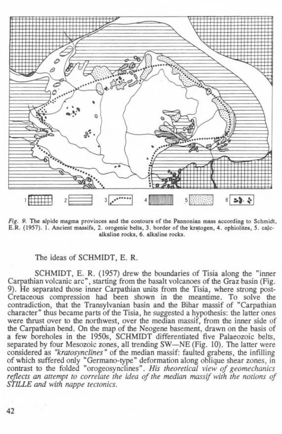
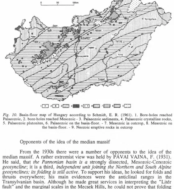
Developments of tectonic views in H ungary...40
Selected bibliography...58
BRIEF HISTORY
OF HUNGARIAN GEOLOGY
P r e f a c e
History o f the nearly two-hundred-year-old Hungarian geology has been extensively investigated in recent years. Though entitled the Brief History of Hungarian Geology, this study includes the history o f stratigraphic and tectonic research only. It is a piece o f a series, the first issue o f which was published on the history o f mineral resource exploration in 1989 on the occasion o f the Washington INHIGEO Symposium. Work is in progress on the mineralogical-petrological and palaeontological volumes.
The present work describes the development o f geology (stratigraphy and tectonics) from the beginning up to the present, including the geological research carried out in the area o f one-time Hungary.
The Editor
Geographic location and national history
Development of geological studies in Hungary — providing solid fundaments for miners’ experiences — has been greatly influenced by changes in the state territory, and by political, social, and economic conditions. Therefore the place of Hungary within European geography and history is briefly reviewed here.
Hungary belongs to Central Europe, both by its geography and history.
Lying in the middle between Iberia and the Ural, it is found in the basin surrounded by the Alps, Carpathians and Dinaric Mountains. During most of its 1100 year history it extended to 325,000 sq km — together with associated Croatia-Slavonia
—, fully occupying the lowlands (Little and Great Plain, Transdanubian Hills, Drava and Sava interfluves, Transylvanian Basin) and the mountains (Figs. 1,2).
Unity of this region had been maintained even during 150 years of Turlash reign and the Habsburgs’ dividing policy; it came to an end in the 20th century only (since the 1920 and 1947 Paris treaties closing World War I and II, respectively, Hungary is 93,000 sq km). A historical account of Hungarian geology discusses much larger territory before than after 1920.
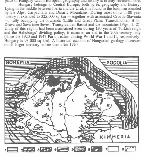
?EZ3 >WB «! 7 l I s E ü ü ]
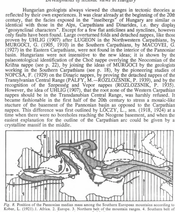
Fig. 1. Orogenetic sketch of the Carpathian Basins according to Prinz, Gy. (1926). 1. Remnants of the Palaeogene peneplains, 2. strikes of the Palaeogene folds, 3. Neogene folds, 4. Carpathian Klippenzone, 5. parts of the submerged Neogene folds, 6. Neogene volcanoes, 7. unfolded platforms,
8. assumed contour-line of Tisia. K: Little Plain, N: Great Plain, E: Transylvanian Basin
Hungary lies in the wide contact zone between German and Slavic peoples.
Hungarian tribes —■ containing a mixture of Fenno-Ugrian and Onogur (Turcic) peoples of the Ural-Altaic family of languages — drifted westwards from easternmost Europe (approximately the present-day Bashkiria) during the great invasions. The first known locations of the migration — caused by attacks of neighbouring nomadic people — are between the river Don and the Azov Sea, then between the river Dniester and the lower reaches of Danube. The Carpathian Basin was occupied in 895-896, although mounted Hungarian troops reached the eastern margins of the Frankish empire from 862 onwards, and fighted against the Moravian ruler as allies of ARNULF, the king of Franks. When LEON THE WISE, emperor of Byzantium left them in the lurch in the war against the Bolgars, to avoid an oncoming attack of Pechenegs the Hungarians crossed the Carpathians, led by prince ÁRPÁD. Defeating the Slavic and Bolgarian peoples left over from the Avar empire destroyed by CHARLEMAGNE in 803, occupied the grasslands and open woodlands of the Carpathian basins, extending the borders of their country as far as the ridge of the Carpathian chain. The well-defendable natural
Fig. 2. Parts of the Pannonian Basin. B: Börzsöny-Visegrád Mts. Ba: Bakony Mts. Bü: Bükk Mts. BP:
Buda-Pilis Mts. C: Cserhát Mts. FG: Fruska gora. G: Gerecse Mts. LC: Little Carpathians. M: Mecsek Mts. Ma: Mátra Mts. P: Psunj Mts. Pa: Papuk Mts. R: Rosalie Mts. T: Tokaj Mts. V: Vértes Mts.
Ve: Velence Mts. Vi: Villány Mts. Z: Zagrebacka gora. Crossed: Tertiary volcanic mountains belonging to the internal volcanic garland of the Carpathians
boundaries, the basins with rich pastures, forests rich in games, hills abounding in ores and salt helped their survival despite extensive agriculture and slow social development.
Experiences of a century after ARPAD’s conquest led prince GÉZA to the adoption of Christianity, associated with final abandonment of nomadic lifestyle.
His son, ST. STEPHEN — to empasize independence from both the Holy Roman and the Byzantine Empire — requested and has got the royal crown from Pope SYLVESTER II. He founded the Hungarian kingdom, complying with contempora
neous feudal Europe, but having a different internal structure. The new kingdom, situated between the Germans and the northern and southern Slavs, have been frequently threatened by new invaders from the east (Pechenegs, Kumans, Jazygians, Mongols) and the East Romanian Empire from the south. However, it successfully preserved its independent status. Medieval rulers of Hungary extended supremacy to the Bohemian basin, to the Dalmatian coast, and as far as the Black and Baltic seas. During the reign of ANJOU kings (CHARLES ROBERT and LOUIS THE GREAT) following the dying out of the ÁRPÁD dynasty (1301), Hungary was one of the great powers of Europe.
Besides the fights for the throne of LOUIS THE GREAT at the turn of the 14th and 15th century, the Hussite war following the Czech reformation and the first Transylvanian peasant revolt a new peril emerged on the Balkans: the advancing Ottoman-Turkish Empire, stopped only temporarily by TIMUR LENK’s Mongolian Empire. This attack, aimed actually at Vienna, was repelled with the leadership of the HUNYADI family of the lower nobility. During the reign of MATTHIAS HUNYADI (1443-1490), the last national king, the country became the home of Renaissance culture. However, in 1492 — when the Spanish were driving out the Arabs from the Iberian peninsula and COLUMBUS was sailing towards America — the Turks overrun Transylvania again. Four years later they occupied the Rumanian principality of Wallachia then Nándorfehérvár, the present- day Beograd. The crusade against them resulted in a peasant revolt in 1514. The cruel revenge after the suppression of the revolt and the rivalling nobles fatally weakened the country and not even the well-disposed assistance of the Popes of the time could help. As a consequence of the disagreement and undiscipline the small Hungarian noble army lost a battle and a king at Mohács in 1526. Therefore the Medieval Hungary ceased to be a power o f Europe.
The death of the monarch led to the election of two new kings and a twelve-year-long civil war. The nobility, which did not trust in its own power and dared not to arm the heavily punished serfs, waited for Europe to help. Those noblemen and dignitaries of the church who wanted a national king, trusted in papal, Venetian, French, Polish and even English help. The other party rallied round FERDINAND of HABSBURG, ruler of the neighbouring Austria. They thought that CHARLES V, king of Spain and its American colonies, emperor of the Holy Roman Empire, would effectively support his brother, FERDINAND.
Both groups had to realize that these countries turned their attentions to the fight
for the absolute power on Europe, therefore they did not want to make a war
against Turkey. In fact the French king concluded an alliance with them against
Spain in 1541, the year when the Turks occupied Buda, the Hungarian capital. In
1547, after an unsuccessful attempt to stop them, FERDINAND signed a peace
with the Ottoman Empire, for whom Transylvania had already payed taxes and the
plains and hills of Hungary meant a parade ground for the following campaigns against Austria.
Thus — while LOPE DE VEGA and SHAKESPEARE were writing their dramas — Hungary was tom into three pieces: Upper Hungary and a part of Transdanubia was ruled by the HABSBURGs. The eastern part was governed by the Princes of Transylvania, who had a certain independence despite being vassal to the Turkish Emperor and took several steps against the despotism of the HABSBURGs in Upper Hungary. The central, wedge-shaped territories with uncertain borders were relentlessly exploited and destroyed by the Ottoman-Turkish Empire. The Turkish occupation, by its nature, meant big campaigns and endless wars. The serfs and gentries, plundered by the Turks and the royal troops, lived in exile and fell victim to the battles for the border fortresses. Though the policy, administration, religion and social system were radically different in the three parts of the country, the resistance against the Turks and the assimilating efforts of the HABSBURGs kept the national feeling alive.
Following the activity of Miklós ZRÍNYI and the victory at Szentgotthárd there was a real opportunity to drive the Turks out of Hungary. The HABSBURGs, however, realized its importance just after the siege of Vienna in 1683, when only the brave troops of Jan SOBIESKI, the Polish king could repel the attack.
Following the siege the European countries lined up with Hungary and with the immense help of Pope INNOCENT XI a long campaign, crowned with the victory of EUGENE OF SAVOYA at Zenta in 1697, liberated the country. As a consequence the Principality of Transylvania, the stronghold against the absolutism and religious intolerance of the HABSBURGs for 150 years, ceased to be an independent state. Transylvania was not reannexed to Hungary but became an Austrian province and remained in a state of dependence till 1867.
The Turkish occupation basically changed the ethnic distribution in Hungary. The Hungarian population moved to the bigger market-towns, where they could live a better life and avoided the Turkish slavery. The abandoned areas were filled up with Serbians in the south and Rumanians in Transylvania and the eastern parts of the Great Hungarian Plain. This process accelerated when Germans and Slovaks were settled to the liberated but uninhabited lands in order to protect and cultivate them. The Vasvár peace-treaty (1664), which was unexplainable in the light of the victory at Szentgotthárd, stirred up the feelings of dissatisfaction amongst the noblemen. However, the HABSBURGs crushed the alliance against the reigning family and the war of independence led by RÁKÓCZI. The differences between the centralizing and arbitrary Austrian government and the Hungarian nobility who worried about the usage of the Hungarian language, the freedom of religion and their feudalistic privileges, became more pronounced. This contributed to the fact, that the vast lands of Hungary were filled up not with the diminished, still rebellious Hungarians but Slovaks, South Slavs, Germans from all over the empire and Rumanians, who were thought to be obliged for the several favours.
Though the Hungarian nobility acknowledged the inheritance of the female line of the HABSBURG-dynasty and the Hungarian army supported MARY THERESA in the Austrian war of succession and in the Seven Years’ War against Prussia, Jhe attitude of the Austrian government towards the country did not change.
Foreign persons and ethnic groups had been received into Hungary since
the reign of ST. STEPHEN. Most of these groups assimilated during the centuries
or remained loyal to the Hungarian state. But in the 19th century nationalism became popular amongst the South Slavs and Rumanians, who were settled down after the Ottoman occupation, and the Hungarians, as well. The aftermaths of this appeared during the 1848 Hungarian War of Independence, when these minorities were hostile towards the Hungarians. The Holy Alliance — which was formed in 1815, following the Napoleonic wars, to repress the ideas of the French Revolution
— could not stifle the desire of the peoples to form nation-states and shape their own future. In 1848, similarly to many countries in Europe, a revolution broke out in Hungary. Although the HABSBURGs, in alliance with the Russian Czar, cruelly suppressed the revolution, the defeats in the Italian war and against the Prussians (1859 and 1866) forced them to compromise with the Hungarians following 18 years of despotism, and establish the Austro-Hungarian Monarchy. This, besides cherishing the illusion of a "political nation", made way for the development of the capitalism. After 47 years of relative quietness the Monarchy went to the World War I in league with the Germans and was defeated. The finishing stroke was given to the Monarchy and the 650-year-long HABSBURG dominion in Europe by the subdued nations in 1920. The independent Hungary lost almost two thirds o f its territory and encountered immense economic difficulties. Due to the geopolitical situation of the hesitant country, Hungary went to the World War II. Between 1939 and 1944 the Hungarian dominated regions of the successor states of the Monarchy were reannexed to Hungary. But at the end of the war the winning Allied Powers did not acknowledge the reannexation and the borders remained the same as determined in the Paris treaties.
During the 45 years of Soviet occupation the political structure of the country had to follow the strongly centralized example of Moscow. Although the 1956 revolution against this system was suppressed by the Soviet intervention, Hungary, taking advantage o f the decline o f the Soviet Union, became an independent, democratic republic.
Beginnings and development of Hungarian geology (Middle Ages and modern times until 1868)
See Selected bibliography: A and B
Use of iron and noble metals had been widespread among ancient Hungarians before arriving in the Carpathian basin. There are remnants of primitive iron smelters in Hungary from the 10th to 12th centuries. Artistic applications of iron — instead of bronze — is known from the 13th century (PEREHÁZY, K.
1982). The most important noble metal mine region of the early centuries was at Selmecbánya (Banstcá Stiavnica, Slovakia): the silver denarius of King ST.
STEPHEN (early 11th century) was made of the metal extracted in these mines by
foreign miners (hospes). Further noble metal and copper were extracted in Szepes-
Gömör Ore Mountains (Slovenské rudohorie, Slovakia), Rudabánya, Tokaj
Mountains and in the Börzsöny as well (Fig. 3). Written documents on the renewed
working of gold mines and on gold panning in Transylvania — started by the
Romans — and on new explorations at Nagybánya are available from the 13th
century onwards. The new industry has been established by Saxonian miners settled
Fig. 3.The gold mines of Hungary in the Middle Ages (Zsámboki, L.1982)
after the devastation of Hungary by the Mongol army in 1241—2. The new settlers made all branches of ore mining flourishing: Hungary became a leader in noble metal production o f the world for about 200 years, partly due to the mining laws of 1327—8 of King CHARLES ROBERT. Decline began at the beginning of the 15th century; the lowest production was reached at the beginning of the 16th century due to the exhaustion of reserves in the oxydation zones, considerably lower ore content of the depth and also due to political disturbances. However, the interval between the end of the 15th century and the middle of the 16th century yielded a boom fo r copper production due to investment by the THURZÓ—FUGGER group (ZSÁMBOKI, L. 1982).
Hungary could play only a minor role in founding geological thinking until the middle of the 19th century. Although the country had been liberated from a 150-year-long Turkish occupation, another 150-year-long paralysis followed due to the following reasons: (1) Hungarian nobility hanging on to its privileges; the peasants denied of the right of free migration; (2) Germanizing policy of the HABSBURG rulers, their measures against the Reformation and their customs policy cutting Hungary off her traditional markets; (3) feudal mine law acting against the development of mining; (4) pushing of Hungary into a semi-colonial position of primary producer; standstill of industrialization due to lack of buying power, rapid capital accumulation and free labourers. (E.g. manufactures were founded in Vienna as early as in 1667, while the first one in Hungary was established in 1715 only; in absence of other consumers, it was to supply the army with broad-cloth. Most of the population used products of craftsmen and homecraft.)
After suppressing the RÁKÓCZI rebellion in 1711, rulers of the 18th century, to cover war expenses, were concerned about the development of noble metal, copper and salt mines, which had been turned to crown monopolies already in 1567. A School of Mines was established in 1733 at Selmecbánya, which became a Mining Academy in 1770. Early teachers establishing European-level standards of the school were MIKOV1NY, S. and the two HELL brothers. Mineralogy, metallurgy and chemistry were taught from 1758. Iron ore and coal exploration were encouraged, however, only after annexation of Silesia by Prussia in 1763 (and following the thinning of forests due to pearl-ash and charcoal burning). Only a few of the landlords’ explorations lived long. The others could save their investment only in cooperation with the treasury due to lack of expertise and capital. Therefore the latter dominated iron production by the first half of the 19th century. However, the iron industry was low level due to lack of capital, feudal ruling, and the obsolete charcoal heating.
The first notice on a coal occurrence in Hungary was made by the German
jesuit KIRCHNER, A.; outcrops at Zsolna (Zilina, Slovakia) and Dobsina
(DobSiná, Slovakia) were reported by CSIBA, I. In Hungary, however, coal was
first applied for smeltering and in a steam engine by engineer POTTER, I. an
Englishman, at Selmecbánya (Banská Stiavnica, Slovakia) and at Újbánya (Nová
Baba, Slovakia) in 1730. The teachers of the School of Mines studied its distillation
and chemical properties. After opening the first coal mines at Trnavka and Trubin,
several others followed till the end of the century. Absence of demand, bad roads,
and high transport costs prevented flourishing till 1830: then the start of steam
shipping and steam milling, and, from 1867, the building of the national railway
network helped to grow mining.
The promising geological exploration that had begun at the turn of the 18th and 19th centuries stopped all over the HABSBURG empire following the economic decline due to the Napoleonic wars. Even in Austria it was mostly carried out by foreign (French, English and Swiss) explorers (ZITTEL, K. A. v. 1899).
The royal court in Vienna paid more attention to mining than any other branch of industry between 1710 and 1850. The first industrial statistical record was performed in 1771-4, then repeated in 1784. Therefore contemporaneous geological literature discussed mineral localities only. Among the authors there were German, Italian, Norwegian, Holland, French, and British travellers, officials and professors at the Selmecbánya Academy. From the second half of the 18th century, however, the number of Hungarian and ’’Zipser” priests, doctors, teachers, commoners, and aristocrats reporting on geological curiosities in Hungary suddenly increased. First they published in Latin and German, then in Hungarian. Their number grew further during the reform movements starting in 1830 and leading to the War of Independence in 1848-9, when Hungarians tried to fill up gaps in fields involuntarily neglected before. The Hungarian National Museum, founded by Ferenc SZÉCHENYI in 1802, moved to its recent building, the first railway and Danube steamship lines were opened, the Chain Bridge between Buda and Pest, the first permanent bridge over the Danube was built, and activities in the Class o f Mathematics and Science o f the Hungarian Academy o f Sciences (founded by István SZÉCHENYI in 1825) started in 1832. The idea of tins institution, already called for by APÁCZAI CSERE, J., BÉL, M., BOD, P., and BESSENYEI, Gy. -
17th—18th century — now came true.
The following general studies published before 1850 worth mention: *BÉL, M., ‘FRIDVALDSZKY, J., ‘BORN, I., SCOPOLI, J. A., FERBER, J. J.,
‘FICHTEL, E. J., ESMARK, J., TOWNSON, R., ‘KITAIBEL, P., STÜTZ, A., STASZICZ, J., SCHÖNBAUER, V ., CLARKE, E. D., ‘ZIPSER, C. A., ‘JÓNÁS, J., BEUDANT, F. S., BOUÉ, A., LILL V. LILIENBACH, K., PUSCH, G. G.,
‘FRIDVALDSZKY, I., ‘FÉNYES, E. Attempts for a Hungarian terminology in mineralogy were published by *BÉNKÓ, F., ‘ZAY, S. SZABÓ, J. established Hungarian mining terms. Besides the studies of STASZICZ, BEUDANT, BOUÉ and LILL V. LILIENBACH the book of *KATONA, M. also reflects the propagation of geological thinking.
The above-mentioned stagnation of Austrian geology has been broken by the excellent organizer HAIDINGER, W. v. He edited the first general geological map of the empire in a scale of 1:864,000, displaying 25 formations (1847), organized the Geologische Reichsanstalt in Vienna (1849), and established the regular geological surveying of the provinces, and published the associated geological descriptions. He also proposed that at least a geological society should help the work of the Geologische Reichsanstalt in Hungary.
The Hungarian Geological Society, with the aim of ’’promoting the exploration of all kind of mineral resources” was founded on the eve of the Hungarian revolution (3 January 1848). Its aim served so well the inevitable capitalistic developments, that even the cruel oppression after the failure of the War
* denotes Hungarian authors.
of Independence could not liquidate it. Even the Austrian/Hungarian customs boundary had to be cancelled. The freely arriving Austrian capital investments yielded new coal and iron mines. Railway and water transportation have developed and flood control along the rivers (initiated by István SZÉCHENYI) recovered.
Serfdom was abolished and landless peasants became workers.
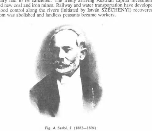
Fig. 4. Szabó, J. (1882-1894)
Geologists of the institute in Vienna prepared the 1:144,000 geological map of the Northern Carpathians (besides practical studies in Transylvania, Banat and Mecsek). Their experience drawn from the study of the Alps could be well applied in subdividing the Permo-Mesozoic and the Eocene. Several formation names given by them are still in use. They recognized the significance of the Miocene rhyolite tuff levels, the local representatives of the Horn beds, the Leithakalk, the
’’Cerithium” and the ’’Congeria” beds, and that basalt eruptions are younger than andesite and rhyolite masses. Also the studies of PETERS, K. near the capital of Hungary (1857, 1859), in the Mecsek (1862, 1863a-b) and in the Bihar (1861) should be mentioned. He was the professor of the Pest University from 1855 to 1860. Although the work of the Vienna geologists süli lacked tectonic viewpoints even in the summary of HAUER, F. R. v. (1869-70) and in his 1:576,000 scale geological map (102 formations), their influence on Hungarian geologists is indisputable.
Initially the Hungarian Geological Society supported collecting trips, then
larger projects, too, and served as,a cohesive force. BÖCKH, J. (1866, 1867),
HOFMANN, K. and rarely SZABÓ, J. (1860) participated in the surveys of the
institute in Vienna. Collecting trips of KUBINYI, F. (1853, 1854, 1856, 1863a-b,
1866, 1867 and KUBINYI, F .—KOVÁTS, GY. 1863) and his descriptions of
beautiful landscapes in Hungary (KUBINYI, F .—VAHOT, I. eds., 1854) supported national feelings. HANTKEN, M. (1861, 1864, 1865, ,1866, 1868, 1870) took the task of age determination of the Kiscell Clay. PETTKÓ, J. (1856) was the first to report oil and gas traces near the river Morava. HUNFALVY, J. (1863-5) attempted to review the natural conditions of Hungary. SZABÓ, J. (Fig. 4) was engaged in the preparation of his Mineralogy (1861), in the description of the geology of Buda-Pest (1856a-b, 1858, 1859, 1867a), in the mapping of the Great Plain (1863, 1867b, 1869a), Tokaj Hills (1866a-b), and Mátra (1869), and in basalt studies (1865, 1867c, 1870). His studies on the terraces of the Danube (1862) made him one of the founders of neotectonics. Besides excellent work in teaching and education, he was ready to popularize geology (SZABÓ, J. 1893).
The year 1867 brought significant changes into the relationship between Austria and Hungary. Independent Hungarian ministries were set up. The newly established (8 September 1869) Royal Hungarian Geological Institute was entrusted by the geological mapping of the country. From 1871 the institute had its own publication outlets. Five geologists satisfied all demands at the beginnings, but their number grew to 11 by 1885, and to 16-17 by 1907. Beginnings of Hungarian geological mapping is discussed by FÜLÖP, J. and TASNAD1 KUBACSKA, A.
(1969a-b).
Results of stratigraphic investigations See Selected bibliography: C
Further development of Hungarian geology was uninterrupted only in the present-day territory of Hungary. Its activity between 1870-1920 and 1939-1944 beyond the present borders provided only foundations for the modern geological picture. In the following pages we supply information first concerning the historical, then on the actual territory of Hungary.
Studies outside present-day Hungary Southern Carpathians (Romania)
One of the most difficult problems was the subdivision of metamorphic rocks, mostly due to the general underdevelopment of this field of research.
BÖCKH, J. (1879) subdivided the crystalline schists into three groups of depth according to the degree of metamorphism. Acidic and basic intrusions had been considered as Archaean until 1896. "Die finding of a Lower Carboniferous fauna at Korniareva (SCHAFARZIK, F. 1895) proved Lower Carboniferous age of the (epi)metamorphic Group III rocks in Krassó-Szörény county, unconformably overlain by the Upper Carboniferous coal measures of Ujbánya-Szekul. Therefore the Variscan granites intruded into Carboniferous sediments have been separated from granites intruded in the more metamorphic Group I and II formations. ,
Already BÖCKH, J. recognized, that possibly older mesometamorphic
rocks overlie epimetamorphic rocks in the Krassó-Szörény Mts. However, key areas
to understand the structure of the Southern Carpathians, lay in the territory of
Romania. Therefore the Romanian MRAZEC, L. (1896) was the first to show — corroborated later by the Hungarian SCHAFARZIK, F. (1911, 1914) — that BÖCKH’s Group I is only a more throroughly intruded part of the epimetamorphic Group III. The relationship of the remaining two groups (II and III) has been cleared finally by MURGOCI, G. (1905a-b). He said, that Group II (mica schists) forms a north verging nappe over Group I (phyllite); the latter still has some remnants of a Mesozoic fossiiiferous sedimentary cover. A further evidence has been put forward by SCHAFARZIK, F. (1898) by finding a single specimen of the ammonite Holcophylloceras mediterraneum (Dogger) in the schistose Schelea Formation, outcropping in the tectonic window of the Szárkő (Tarcu) and Retyezát, and considered as Palaeozoic before. Views of Hungarian and Romanian geologists on the Retyezát and Páring Mts. are summarized by NOPCSA, F. (1905a) in his
1:200,000..map and description.
BÖCKH, J. (1888) has found at Szászkabánya (Sasca Montaná) the brachiopod-bearing Anisian limestone and Ladinian marly dolomite, overlying the red conglomerate and plant-bearing sandstone, which was thought to be the only representative of the Triassic system in the Southern Carpathians for a long time.
Gresten-type Liassic with coal measures and a complete Jurassic sequence overlying crystalline schists have been found by Hungarian geologists in the Krassó-Szörény and Almás (Almáj) Mts. and in the Cserna (Cérna) valley. In the eastern part of the Krassó-Szörény Mts. a gradual transition has been observed between Tithonian and Berriasian; the overlying bluish grey shale has been ranged to the Valanginian and Hauterivian, while the Zementmergel to the Barremian—Lower Aptian. Lower part of the Barremian—Lower Aptian is filled by Urgonian limestone in the western part of the mountains. Its sandstone and marl cover may reach up to the Cenomanian.
Reports of SCHAFARZIK, F. (1911, 1914) and SCHRÉTER, Z. (1912a) indicate that the stratigraphic buildup of the Southern Carpathians was known by the beginning of the 1910s, although no monograph has ever been published.
Mountains bordering Transylvania to the east and west (Romania)
Sporadic, minor Triassic outcrops in the Eastern Carpathians were first reported by HERBICH, F. (1871) (fossiiiferous Werfenian shale, Middle Triassic sandstone and shale, radiolarite, Hallstatt limestone, Rhaetian coral limestone). He has found Mesozoic igneous rocks as well (1859, 1878). First descriptions of the Jurassic at Brassó (Bra§ov), Persány (Per§ani) Mts. and Nagyhagymás has been published by HERBICH (1871, 1878), too. Further descriptions of Mesozoic faunas at Brassó were published by JEKELIUS, E. (1914, 1916-1925).
The mountains bordering Transylvania to the west have been neglected for a long time. SZABÓ (1874) reported on the "trachyte” there. Several authors studied the so-called "massive rocks”: KOCH, A. (1885) and KOCH, A.- KÜRTHY, S. (1877) on the Vlegyásza, LÓCZY L., sen. (1876, 1886, 1887) on the Hegyes-Drócsa, PRIMICS, GY. (1879, 1891, 1893) on the Transylvanian Ore Mts. and the Bihar. After the death of PRIMICS, GY. the studies on the Vlegyásza tias been continued by SZÁDECZKY, GY. (1903, 1904, 1905a, 1906, 1907). The Mesozoic formations of Transylvania have been reviewed by KOCH, A. (1905a).
Regular mapping has been initiated by the Hungarian Geological Institute in 1885.
It was due to harsh terrain, logistic problems, organizational mistakes and serious
illnesses that only pioneer results were yielded even after 20 years of work.
However, PETHO, GY. (1892, 1896, 1897) and BÖCKH, H. (1904) recognized three members in the continental Permian overlying the crystalline basement of the Béli Mts. (Codru Moma) (Verrucano, shales alternating with acidic volcanics, Gröden beds). The subdivision of the Triassic and Jurassic was supported by rare fossils collected by PETHŐ, GY. (1893), BÖCKH, H. (1904), PAPP, K. (1905, 1906), and KOCH, A. (1885, 1905a). Special importance can be attached to the Middle Triassic ammonites at Vaskoh (Va§c3u) (LOCZY, L „ sen. 1886) and to the Gryphaeas in the Gresten beds of Menyháza (Moneasa) (BOCKH, J. 1887).
The subdivision of the Triassic and Jurassic sequence of the Királyerdő (Pádurea Craiului) was an excellent product of HOFMANN, K. (in SZONTAGH, T. 1899): Werfen shale, Triassic dolomite and limestone, Gresten-type Liassic and the presence of all significant Jurassic levels, except the Middle Dogger.
SZONTAGH, T. (1890) recognized the Barremiancalcareous marl and ’’Caprotina”
limestone (Aptian) (SZONTAGH, T. 1893—1906) in the Királyerdő, besides the Lower Cretaceous at Nagyvárad (Oradea).
The Tithonian-Lower Cretaceous limestone klippen in the neighbouring Transylvanian Ore Mts. has been described by LÓCZY, L., sen. (1876) as masses embedded in the Hauterivian flysch. In the following year he found that the folded Lower Cretaceous flysch is unconformably overlain by Cenomanian and Senonian sediments (the latter as Gosau facies).
In the sensu stricto Bihar Mts. the first significant result has been reached by ROZLOZSNIK, P. (1906a-b). He noted (and described it much later, in 1937) that the surroundings of the Nagybihar (Cucurbeta) are made of two metamorphic complexes, which overthrusted the Mesozoic to the north before the Senonian. His metamorphic units are now called by Romanian geologists as Biharia and Mungel- Lup§a nappes of the Bihar nappe system.
The reambulation of the sensu lato Bihar Mts., initiated by LOCZY, L., sen. in 1909 (participants: SZONTAGH, T .-P Á L F Y , M .-ROZLOZSNIK, P.
1910, 1911, 1912) yielded the recognition that this massif is made by decollement nappes. PALFY, M. (1915, 1916) and ROZLOZSNIK, P. (1906a-b, 1913) recognized, that the Carboniferous sediments (quartz conglomerate, grauwacke and shale) cover the crystalline schists only in the southern part of the Bihar massif; the Permo-Mesozoic of the overlying nappes is made of nearshore and open marine sediments similar to the High Tatric and Subtatric sequences of the West Carpathians, recognized by UHLIG, V. (1903, 1907). The autochthonous Permo- Mesozoic, forming the sedimentary cover of the crystalline basement of the Béli Mts., is very similar to that of the Carpathian core mountains (especially the
"variegated Keuper” , the Kössen beds and the Gresten-type Lower Liassic) (PÁLFY, M., 1926; KUTASSY, E. 1928, 1937).
The events of World War I interrupted the study of the bauxite deposits of
the Királyerdő and South Bihar (first notes by SZÁDECZKY, GY. 1905b; further
studies by ROZLOZSNIK, P. 1917, 1918, 1923, 1925). Prolonged problems after
the Paris peace treaties, including the deaths of former co-workers (PÁLFY,
KUTASSY, then ROZLOZSNIK himself), caused that only part of the results have
been published as the first (and, unfortunately last) volume of a monographic study
(ROZLOZSNIK, P. 1939) (Fig. 5). This — although incomplete — volume
describes the history of the "Bihar geosyncline” surrounded by the crystalline
massifs of Bél (Beliu), Gyalu (Giláu), Réz (Plopig) Mts. and Cikó-Preluka (Ticáu—Preluca). Sedimentation started in the Permian. There are two main facies belts: a) ridge facies (Schwellenfazies) of the Királyerdő and the northern and middle Bihar; b) an offshore Bél facies; its most complete sequence is in the Nagyarad (Izoi) unit. The tectonic nappes in Bél facies, originating from the valley of the Fekete-Körös (Cri§u Negru) eastward and westward overthrusted the Bihar ridge facies. PÁLFY and ROZLOZSNIK — by proving nappe tectonics — were the first to express well-founded doubts on the unity of the so-called ’Hungarian M assif filling the interior of the Carpathian basin.
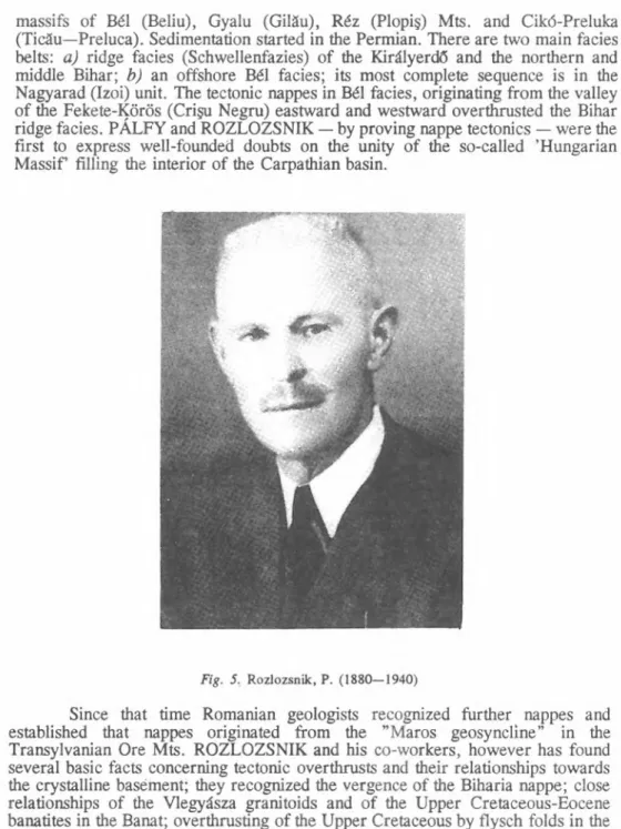
Fig. 5. Rozlozsnik, P. (1880—1940)
Since that time Romanian geologists recognized further nappes and
established that nappes originated from the ’’Maros geosyncline” in the
Transylvanian Ore Mts. ROZLOZSNIK and his co-workers, however has found
several basic facts concerning tectonic overthrusts and their relationships towards
the crystalline basement; they recognized the vergence of the Biharia nappe; close
relationships of the Vlegyásza granitoids and of the Upper Cretaceous-Eocene
banatites in the Banat; overthrusting of the Upper Cretaceous by flysch folds in the
Maros (Mure§) valley (due to post-Gosau movements); and the Tertiary age of the
andesites in the Transylvanian Ore Mts.
Dánián dinosaur bones have been found by NOPCSA, F. (1915) in the post-Senonian beds of the Hátszeg (Ha]eg) basin. A ’’hyper-Senonian” clay and marl succession with basic volcanics has been found by PETHŐ, GY. (1910) on the top of the Upper Cretaceous overlying the crystalline core of the Fruska gora (Yugoslavia) (visited earlier by KOCH, A. l0O3). JThe embedded marine fauna contains Palaeocene forms, as considered by PETHŐ.
Transylvanian basin (Romania)
Four Palaeogene sedimentary cycles have been recognized by HOFMANN, K. (1886, 1887) and KOCH, A. (1884, 1894) in the northern margin of the Transylvanian basin. The complete Neogene adjoining it to the south was subdivided by KOCH, A. (1900) with the help of intercalated volcanic tuff levels and by the "Upper Mediterranean” (now Badenian) salt deposits. In contrast, the Middle Miocene in the minor basins of the Southern Carpathians and Transylvanian Ore Mts. (Vajdahunyad, Karánsebes, Bozovics, Déva) [Hunedoara, Caransebe§, Bozovici, Deva], at the western side of the Krassó-Szörény Mts. and in the FruSka gora immediately overlies the crystalline basement or the Palaeo-Mesozoic. Rich gastropod and bivalve faunas of the transgressive Badenian have been described by HALAVÁTS, GY. (1876, 1881, 1884), KOCH, A. (1898), MÁRTONFI, L.
(1893) and VADÁSZ, M. E. (1907) (Felső-Lapugy, Kostéj, Ribice, Bujtur) [Lápugiul Superior, Co§teiul-de-Sus, Ribi{a, Hunedoara], The "Aquitanian” coal measures of the Zsil (Jiu) valley has been studied by HOFMANN, K. (1870a) and STAUB, M. (1887).
The successful Kissármás (§árma§elu) drilling — bored for potash salt by PAPP, K. (1909, 1910) — found natural gas in anticlines. The following positive results of BÖCKH, H. (1911a-b, 1912, 1913, 1914) and PÁVAI VÁJNÁ F.
(1917a-b, 1925) here and at Morvamező (western foreland of the Little Carpathians), and along the river Mura initiated further hydrocarbon exploration in Southern Transdanubia and the northern margin of the Great Plain after 1920.
Neogene of the Transylvanian basin was reviewed by GAÁL, I. (1912), while folding tectonics by PÁLFY, M. (1912).
During 1941-4 a team of Hungarian geologists, led by BAND AT, H.
(1950a-b) and consisting of REICH, L. (1950), BARTKO, L. (1950), MAJZON, L. (1950a-d), BEM, B. (1950), BÖHM-BEM, B. (1944), JASKO, S. (1942, 1950a- d), MÉHES, K. (1944), SZALAI, T. (1950), SZENTES, F. (1950a-b), WEIN, GY. (1950a-b), and BÁLOGH, K. (1950a-b) re-mapped the northern margin and the middle part of the Transylvanian basin. Associated workers were KEZ, A.
(1950), KESSLER, H. (1950), MOTTL, M. (1950), PÁVAI VÁJNÁ, F. (1950),
SÜMEGHY, J. (1950), FERENCZI, I. (1950), MIHÁLTZ, I. (1950), and
STRAUSZ, L. (1950). Special studies have been carried out on the Felső-Derna
asphalt occurrence at the margin of the Réz (Plopi§) Mts. (NOSZKY, J. jun. 1950a-
b), on the Pliocene sediments of the Barót-Köpec (Baraolt-Cápeni) basin (GAÁL,
I. 1950), on the Preluca crystalline block (SCHRÉTER, Z. 1949), on the nepheline
syenite massif at Ditró (Djtráu) (FÖLDVÁRI, A. 1946, PANTO, G. 1950a-c and
FÖLDVÁRI, A .—PANTO, G. 1950a~c), and on the Lower Cretaceous fossiliferous
localities in the Békás (Bicaz) gorge (NOSZKY, J. jun. 1950c). Valuable
observations were made on the Plio-Pleistocene volcanic ranges of Kelemen and
Görgény Mts. by TÖRÖK, Z. (1942). BANDAT, H. (1942) applied aerophotogrammetry in the exploration of the Mezőség in the Transylvanian basin.
The results confirmed the early statements of HOFMANN, K. and KOCH, A., made at the beginning of the century: the folded Palaeogene flysch of the Lápos (Lápu§) Mts. and equivalent Palaeogene basin facies is overlain by the unfolded
"Lower Mediteranean” (now Eggenburgian-Ottnangian) seuqence of the Ilosva basin, by the "Upper Mediterranean” succession of the Mezőség, partly folded by salt tectonics. The transgressive "Lower Mediterranean” is represented by the lower (Cyclammina-bearing) part of the Hfdalmás beds overlying the basal conglomerate;
die Helvetian (now Őttnangian + Karpatian) stage of the "Upper Mediterranean”
is represented by higher, fossil-free member of the Hfdalmás (Hida) complex. The initial beds of the Tortonian (now Badenian), i.e. the Dés (Dej) dacite tuff and the rock salt, are followed by the Mezőség beds; it contains Anomalinas at the bottom, then, above the Bálványosváralja tuff, it is fossil-poor. It is overlain by the Gyéres tuff, then Sarmatian Syndesmia-bearing clay marl, the Bázna tuff, and the Pannonian Congeria beds.
The Northern Carpathians (Slovakia and Ukraine)
The geological survey carried out in the Northwestern Carpathians by the geological institute in Vienna, terminated in 1867, except local studies for mining geology. Detailed mapping in the scale of 1:25,000 has been started by the Hungarian Geological Institute, headed by LÓCZY, L., sen., in 1913. The project was aimed to decide whether the new synthesis of UHLIG, V. (1907), prepared following the debate with LUGEON (UHLIG, V. 1903, LUGEON, M. 1903) is correct. The work was hindered by World War I, but a few important results has been achieved.
It has been established, that the Choé Dolomite overlying Neocomian marl of the Subtatric unit of UHLIG is not Lower Cretaceous, but Middle and Late Triassic in age (DORNYAI, B. 1913, 1917; KULCSÁR, K. 1916, 1917; VIGH, GY. 1915a; LÓCZY, L. ,jun. 1915a, 1916). Hungarian geologists couldn’t separate the High Tatric (discontinuous) and the Subtatric (continuous) sequences everywhere reliably. The fossil evidence for the Triassic age of the Choé units indicated the presence of a hitherto unknown decollement nappe over the Subtatric formations. The Triassic of this nappe — extending from the Little Carpathians to the Mintchov — is fundamentally different from the Subtatric Triassic due to the absence of the "variegated Keuper” and local presence of the Lunz Sandstone.
Fundamental difference of Triassic sequences in the Subtatric and Szilice (Silica)—Aggtelek—Rudabánya units has been already reflected in the reports of BÖCKH, H. (1906, 1909), BÖHM, F. (1907), ACKER, V. (1905, 1906), KOCH, A. (1904), VITÁLIS, I. (1909), and GESELL, S. (1905). Significant contributions to the Palaeozoic geology of the Szepes-Gömör Őre Mts. (Slovenské rudohorie) were the surveys of ROZLOZSNIK at Aranyida (Zlatá Idka) (1912) and Dobsina (1914, 1915), the fossil finds of KISS, A. (1858), ILLÉS, V. (1902), FRECH, F.
(1906), GESELL, S. (1903), and ROZLOZSNIK, P. (1914, 1915), and the porphyroid studies of SCHAFARZIK, F. (1904-5).
ROZLOZSNIK has shown already in 1915, and described in detail in 1935,
that the Ore Mts. is composed of two fundamentally different units: the Vepor and
the Szepesség (Spi§) nappes. Cambro-Silurian porphyroids and Silurian-Devonian
"greenstone schists” are both unconformably overlain by the Upper Carboniferous (Westphalian) of Dobsina-Bindt and by the mostly terrestrial Permian. Westphalian age of the Dobsina Carboniferous has been proven by RAKUSZ, GY. (1926,
1932).
There was a significant progress in the stratigraphic studies of the South Gömör zone, which briefly belonged to Hungary again during World War II (BALOGH, K. 1940, 1945, 1948; BARTKÓ, L. 1953; NOSZKY, J., jun. 1948;
FÖLDVÁRI, A. 1946, 1948a-b; TELEKI, G. 1948). The Anisian and Ladinian parts of the present-day Szilice nappe have been separated by using dasycladaceans;
the Reifling facies has been recognized; Carnian and Norian members of the Hallstatt facies have been identified by brachiopod and Monotis salinaria finds.
Therefore the succession ranging from the Werfen Beds to the Adnet-type Lower Jurassic — together with the ” Licodus ” limestone indicated by STÜRZENBAUM, J. (1879) and VIGH, GY. (1915b) - became better subdivided.
Hungarian geologists visiting the Northeastern Carpathians between 1887 and 1918 ranged the monotonous successions of the flysch belt (very poor in megafossils) to the Upper Cretaceous and Palaeogene (Lower Eocene is absent).
During World War II WEIN, GY. (1943, 1950) and HORUSITZKY, F .-W E IN , GY. (1950), based on the foraminifer studies of MAJZON, L. (1943) separated the following units: "inner klippen belt”, Magúra zone, Uzsok-Dukla folds, "marginal scales”, Uzsok-Bukovice scale”, and "central depression”. SZALAI, T. (1945, 1947) studied the stratigraphy and structure of Kőrösmező (Jasina) region, while SZENTES, F. (1942) those of the Upper Tisza Miocene basin. SCHRÉTER (1943b) studied the oil region of Izaszacsal (Sácel).
In Zemplén Mts. SZÁDECZKY-KARDOSS, GY. (1891, 1897) recognized the Lower and Upper Carboniferous age of the plant fossil-rich sandstone-shale complex with coal measures located between members of the sequence considered as Devonian and Permian. This age has been modified by FERENCZI, I. (1943) to Permo-Carboniferous, valid up to now.
The eastern termination o f the Alps (Austria)
Phyllitoid rocks without fossils had usually been considered as Lower Palaeozoic by Hungarian geologists. The Middle Devonian fossils found by HOFMANN, K. at Egyházasfuzes (Kirchfidisch) established connection between the Graz Devonian and the Devonian recently recognized in the Balaton Highlands and the Uppony-Szendrő Hills (TOULA, F. 1878 in JUGOVICS, L. 1915, p. 51).
The Croatian karst and the Dinarids (Croatia, Albania, Bosnia and Herzegovina, and Jugoslavia)
Hungarian and Croatian geologists studying the Croatian karst (KADIÖ, O. 1912, 1916, 1923, 1934; KADIC, O.-K ORM O S, T .-V O G L , V. 1911;
KORMOS, T. 1912, 1914; VOGL, V. 1912, 1913a, 1915a-b, 1934; KOCH, F.
1912, 1917, 1923; POUAK, J. 1914; SALOPEK, M. 1914) separated Permo-
Carboniferous, Mesozoic, and Eocene formations. A significant result was the
recognition of the cephalopod-bearing Middle Permian at Mrzla Vodica (VOGL,
V. 1913b). The characteristic calcareous algae of the marine Upper Permian have been found, too (JABLONSZKY, J. 1919), although — following the international usage of that time — these were ranged as Carboniferous.
In the Albanian part of the Dinarides NOPCSA, F. carried out extensive research (NOPCSA, F. 1905b, 1906, 1908, 1911, 1916a-b; NOPCSA, F.-R E IN H A R D , 1914). The reviews of NOPCSA (1921-22, 1929a) mostly dealt with the thick sedimentary sequence overlying the crystalline formations, which can be followed from the Dráva—Száva Interfluve and NW Serbia to Athens. These successions consist of Carboniferous shale and limestone, terrestrial Permian conglomerate and sandstone and a keratophyre-shale-limestone Middle Triassic with
"Han Bulog”-type limestone. This sequence suffered intense tectonic deformation, and contains minor serpentinite bodies. It is unconformably overlain by Upper Cretaceous limestone and Eocene flysch.
The structure of the "Eastern Dinaride serpentinite belt” is even more complex: the Palaeozoic shales and Permian beds are overlain by Upper Triassic limestone with tuffite and megalodontids; serpentinite, gabbro and diabase bodies interfingering with Middle and Upper Jurassic red shale play a major role; the latter are unconformably overlain by clastic Tithonian and Neocomian rocks, rudist- bearing Cenomanian and Senonian to Oligocene flysch.
The western margin of the serpentinite belt is adjoined by the neritic Dinaride limestone belt in the north and by the deep-water Olonos-Cukali belt in the south. Both overthrust the flysch on the Adriatic shore (West Hellenic and Adriatic-Ionian zones).
NOPCSA (1921-2) made a detailed subdivision of the stratigraphic column of the Cukali region ranging from the Lower Triassic to the Lower Eocene- Oligocene flysch. A major difference of the Northern Albanian block (its succession ranges from the Carboniferous to the flysch) compared to that of Cukali is that the flysch facies started to develop already in the latest Cretaceous.
The Hungarian Geological Institute sent a mapping team of 4-9 members to Western Serbia, Bosnia and eastern Montenegro in 1916-8, personally supervised by director LÓCZY, L., sen. (1924). The geologists LÓCZY, L., jun. (1918, 1921, 1927), VAD ASZ, E., KORMOS, T., JEKELIUS, E., SZENTPÉTERY, ZS., TREITZ, P., ZALANYI, B., SZONTAGH, T., ZSIGMONDY, Á., TIMKÓ, L, TELEGDI ROTH, K. (1927a) have recorded a great number of valuable geological data (see Balkanforschung 1918). The 1:200,000 geological map, edited by LOCZY, L., sen. (1924) shows 29 formations ranging from "Archaean”
crystalline schists to the Quaternary. It served Yugoslavian geologists well for a long time.
Studies within the present-day territory o f Hungary
Stratigraphic and palaeontologic research within the post-Trianon territory
of Hungary gradually has increased in the latter 50 years. Mapping has been
supported by laboratory studies and field geologists increasingly cooperated with
specialists of geochemistry, petrology, sedimentology, palaeontology, and
geophysics. An early example of this kind of research is the Balaton monograph,
organized by LÓCZY, L., sen. at the beginning of the century. This was an
essentially different approach if compared to the preceding 110-year-old practice
(field work in the summer, laboratory studies in the winter). In that early stage, stratigraphy was mostly based on the megafauna determined by the mapping geologists themselves. Few of them were capable to carry out the mapping, determine the fossils and write monographs. Notable exceptions are HOFMANN, K. (1871, 1873), the best Hungarian field geologist ever, and NOPCSA, F. (1915,
1917, 1928, 1929b), the high-ranking scientist of dinosaurs, and ROZLOZSNIK, P. (1924, 1927, 1929), who prepared a successful systematics of Nummulites besides studying sedimentary and igneous rocks.
An early pioneer of micropalaeontology was HANTKEN, M. (1871, 1873, 1875). He established a biostratigraphic subdivision of the Palaeogene formations in the Dorog-Budapest area based on larger and smaller foraminifers, extending it as far as Northern Italy. HANTKEN described several new foraminifer species, recognized the sexual dimorphism of Nummulites and drew consequences from the foraminifer assemblages in the Carpathian basin valid up to now. He was a pioneer in applying modern palaeontological methods used by hydrocarbon exploration in the first half of the 20th century . His merits were acknowledged by CUSHMAN, when naming the foraminifer genus Hantkenina and the family Hantkeninidae after him.
The period between 1868 and 1908
Crystalline schists- and granites were considered as Precambrian. Only terrestrial Permian was recognized as Palaeozoic. Most of the Permian was attached to the Triassic due to its close connection with the Werfen beds in the Mecsek and Balaton Highland.
BÖCKH, J. (1872, 1876a-b) recognized two Alpine-type, but different successions in Transdanubia. Both are characterized by increasing carbonate content up to Middle Triassic, then differences prevail. Carbonate rocks dominate the Balaton Highland Triassic, but the Mecsek Upper Triassic becomes clastic. Thirteen members were named by BÖCKH (1872) within the Balaton Highland Triassic;
some of them are still in use. He subdivided the Mecsek Triassic in seven units (2 Werfenian, 3 Muschelkalk, 1 Wengen shale and 1 sandstone without coal) (BÖCKH, 1876b).
Only Upper Triassic has been reported from the rest of the Transdanubian Central Range (KOCH, A. 1875): Hauptdolomit and Dachstein limestone. A few other Triassic members have been recognized in the Buda and Pilis Hills:
’’Mátyáshegy limestone”, ’’Diplopora dolomite”, ’’cherty dolomite”, ’’Avicula limestone” (KOCH, A. 1871; HOFMANN, K. 1870b, 1871, 1873).
In the Aggtelek Karst ’’Seisian”, ’’Campilian”, Gutenstein limestone, and the hardly subdivisible ”plateau limestone” has been recognized (BÖCKH, H. 1909;
VITÁLIS, I. 1909). KOCH, A. (1904, 1905b) moved the white limestone of the Osztramos in the Rudabánya Hills from the Carboniferous to the Triassic.
A fundamental difference has been shown between the Jurassic sequences
in the Transdanubian Central Range and the Mecsek Hills (BÖCKH, J. 1876a,
1880-1). While the former has been observed as small patches and as thin, Alpjne
facies, the latter, much thicker sequence was related to the Gresten facies (coal
measures below, shale and marl above, topped by limestone). The Dogger and
Malm, being known in the Mecsek, were barely identified at a few points in the
Transdanubian Central Range up to the beginning of the 20th century.
HOFMANN, K. (1907) was the first to declare that the Middle Triassic of the Villány area was covered by the Jurassic sea from the Bathonian onwards only.
Alpine Lower Cretaceous succession has been recognized by HOFMANN, K. (1884) in the Gerecse Hills: here the Lower Tithonian limestone of Lábatlan is disconformably overlain by Berriasian sandstone and breccia, followed by Valanginian Aptychus marl and Hauterivian sandstone-conglomerate. Aptian, Albian and Cenomanian have been recognized in the Bakony Hills (HAUER, F.
1862; KOCH, A. 1875): ”foraminifer clay”, "Caprotina and Exogyra limestone”,
’’Turrilites marl”. The fauna found in the ’’augite porphyry tuff” of the Eastern Mecsek Hills proved the Lower Cretaceous age of volcanism (HOFMANN, K .—VADÁSZ, E. 1912).
Upper Cretaceous localities (Ajka, Sümeg, Ugod) of marl and Hippurites limestone overlying freshwater beds with coal measures in the Transdanubian Central Range have been considered as Gosau beds (KOCH, A. 1875).
HANTKEN, M. set up a detailed subdivision of the Palaeogene. He distinguished several horizons within the Eocene overlying the Upper Triassic:
"Operculina”, ”subplanulatus", ”perforatus”, and "striatus” levels. The widely extended Upper Eocene, representing another sedimentary cycle was subdivided as
"Orbitoides limestone” and ”bryozoan marl”, with Nummulites complanatus in the former, and N. incrassatus and N. budensis in the latter.
In the Oligocene HANTKEN (1873) recognized lateral facies changes. For example, he considered the deltaic "Hárshegy sandstone” as equivalent of the
"Buda marl”: both are overlain by the pelagic ’’Kiscell clay”. The Late Oligocene regression is indicated by the nearshore "Pectunculus ”( = Glycy metis) obovatus, the brackish Cyrena-Cerithium and the freshwater Helix-Planorbis facies.
In the Miocene of the Transdanubian Central Range, the Mecsek Hills, and Sopron ’’Lower” and ’’Upper Mediterranean” (FRANZENAU, Á. 1881), and Sarmatian stages have been distinguished based on the recognition of clastic, calcareous, volcaniclastic, brackish, and paludal facies. BÖCKH, J. (1876a) recognized that the "Lower Mediterranean” is absent in the Southern Bakony.
In order to replace the name "Congeria beds” used by KOCH, A. (1872) and BÖCKH, J. (1876a) the Pannonian stage was introduced for the formations lying between the Sarmatian and the Levantian sediments of the Pannonian sea. The introduction of this notion by TELEGDI ROTH, L. (1879) was justified later by the long, emotional debate between HALAVÁTS (1882, 1910, 1923) and LŐRENTHEY, I. (1893, 1909). Several Lower and Upper Pannonian faunal horizons have been distinguished. Existence of minor residual lakes was presumed for the Levantian between the Upper Pannonian and the Quaternary, e.g. in Slavonia, Southern Transylvania, and the Great Plain. In the rest of the country the terrestrial and fluvial sediments of the Levantian stage were correlated by vertebrate fossils.
The period between 1909 and 1919
The best geological monograph of the period is the synthesis of LÓCZY,
L., sen. (1913, 1916, Fig. 6) on the geology of the Balaton Highland. It is the final
volume of a series initiated by LOCZY, then professor of geography and
generously supported by the Hungarian Geographic Society and Andor SEMSEY.
This monumental work — established by exemplary cooperation of Hungarian and foreign specialists from all branches of science — is one of the most important sources of information on the geology of Hungary (published in Hungarian and German).
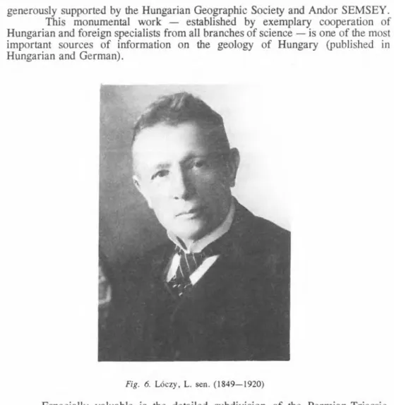
Fig. 6. Lóczy, L. sen. (1849—1920)